Open Source Alternatives
  • Alternatives
  • Categories
    Categories by size1,013 projects
    • Developer Tools517
    • AI & Machine Learning448
    • Business & Productivity232
    • Web Development203
    • Security & Monitoring151
    • Communication & Collaboration138
    • IT Management135
    • Cloud & Hosting119
    • LLMOps & AI Tooling116
    • Data & Analytics111
    Browse all 21 categoriesProduct & Project Management, Design & Creative and 9 more
  • Blog
  • Advertise
SearchNotion, Slack, password manager.../
Submit
Open Source Alternatives
  • Alternatives
    • Developer Tools517
    • AI & Machine Learning448
    • Business & Productivity232
    • Web Development203
    • Security & Monitoring151
    • Communication & Collaboration138
    • Browse all 21 categories
  • Blog
  • Advertise
Submit your project

New open source projects by email

The projects we add and every new guide. Free, unsubscribe any time.

Open Source Alternatives LogoOpen Source Alternatives

Handpicked Open Source Alternatives to Paid Softwares

Product

  • Categories
  • Tag
  • Advertise

Resources

  • Blog
  • Collection
  • Submit

Company

  • Privacy Policy
  • Terms of Service
  • Refund Policy
  • Sitemap

Alternatives

  • Claude Code
  • Jira
  • Notion
  • Slack
  • Linear
  • Wispr Flow
  • All alternatives
© 2026 Open Source Alternatives. All rights reserved.
Open SourceAlternatives
Home/Categories/Data & Analytics/Aleph
icon of Aleph

Aleph

  • 699 stars
  • MIT
  • Active this week
  • Last commit today

Last verified Nov 2, 2026

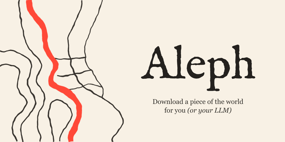
Build a local dataset of satellite imagery, terrain elevation, OpenStreetMap buildings, and Street View photos for any location on Earth.

Visit websiteGitHub699 stars
image of Aleph
TL;DR

Aleph downloads satellite imagery, terrain elevation, OpenStreetMap buildings, and Street View photos for any geographic area to local files. It was built to let LLMs quickly gather physical-world context, but works equally well for geospatial visualization, 3D modeling, and local GIS workflows. MIT licensed, no API keys required, runs on Python 3.11+. Best for AI engineers building location-aware pipelines and for developers or researchers working with 3D city models and terrain data.

Read the full breakdownHide the full breakdownWho it is for, how it works, trade-offs, the quick start and the FAQ
who it's for

Who Aleph is for#

AI engineers building location-aware LLM pipelines

Aleph was built specifically to give language models quick access to physical-world data. You can pull a satellite image, terrain elevation, and building geometry for any address or landmark in one command and attach the resulting files as context to a prompt. The MIT-licensed software and no-account setup make it easy to include in a research pipeline or local prototype.

Skip if:

If your pipeline needs to distribute or publish the location data, Aleph's use of Google's consumer endpoints violates their Terms of Service. Use a licensed API for any commercial or publicly distributed application.

GIS developers prototyping 3D city visualizations

The dashboard captures building geometry from OpenStreetMap as glTF 3D tiles and terrain elevation in one step, saving them to local files. This shortens the data-acquisition loop for prototyping Cesium, deck.gl, or custom WebGL scenes that need real-world geometry. OSM building data and AWS terrain tiles are both open-licensed for this use.

Skip if:

For production mapping applications or any work intended for public distribution, verify the license for each data layer. Google satellite and Street View data are not licensed through Aleph for those uses.

Researchers and hobbyists exploring geospatial data

For educational, personal, and non-commercial research, Aleph downloads terrain elevation and OpenStreetMap data under open licenses. AWS Terrain Tiles and OSM data (ODbL) are usable commercially with attribution. The dashboard's 3D viewer makes it easy to explore terrain relief and city geometry without dedicated GIS software.

Skip if:

If your research will publish or redistribute Google satellite imagery or Street View photos, those layers are not licensed for that use. Stick to the OSM and terrain layers for publishable work.

the problem

The problem it solves#

Gathering physical-world data for an LLM or a GIS project means juggling multiple services: one for satellite rasters, another for elevation tiles, a third for OpenStreetMap building exports, and a fourth for street-level photos. Each service has its own authentication, its own output format, and its own rate limits. Stitching them together into a single local dataset takes engineering time before the actual work begins.

For AI engineers specifically, language models have no spatial awareness of the physical world, and most context-injection workflows handle text and structured data well but have no standard path for attaching a satellite image or a 3D building mesh. Aleph addresses that by packaging the multi-source download into a single command.

how Aleph solves it

How it solves it#

Map dashboard for area capture

A browser-based dashboard opens at http://127.0.0.1:8100 where you draw a rectangle or polygon on the map. You choose which data layers to include, preview the estimated download time, then start the capture. Results are saved in a captures folder, and any capture can be opened to show or hide layers or explore the 3D mesh and terrain relief in the dashboard's built-in 3D viewer.

CLI for single-location downloads

The `alephgeo` command accepts a place name and downloads a satellite image or Street View photo in one line: `alephgeo streetview --place "Colosseum, Rome" --best-match -o captures` fetches the nearest street-level photo. `alephgeo satellite` does the same for imagery. Each download lands in its own folder inside the output directory.

No API keys or authentication

Aleph uses the same public-facing endpoints that power maps.google.com and OpenFreeMap, so there is no billing account, API credential, or quota configuration needed. The only prerequisites are Python 3.11 and three dependencies: Pillow, numpy, and truststore.

Multiple data layers in one capture

A single area capture assembles up to four layers: satellite imagery, terrain elevation tiles, OpenStreetMap building footprints converted to glTF 3D meshes, and Street View photos. Each layer is independently toggleable. The terrain and building mesh layers are explorable in the dashboard's built-in 3D viewer after download.

3D city model output in glTF

Buildings sourced from OpenStreetMap are downloaded and converted to textured 3D tiles in glTF format, compatible with 3D tile standards. The dashboard's 3D viewer renders them alongside the terrain, so you can inspect city geometry, building heights, and elevation relief in the browser without additional tooling.

strengths · trade-offs

Strengths and trade-offs#

Strengths

  • Zero credentials, no billing accountUnlike Google Maps Platform, which requires a Google Cloud project and charges per API request for satellite and Street View access, Aleph needs no credentials. It uses the same consumer endpoints browsers use, so there is no quota management or billing risk for personal projects. This makes it faster to start: clone, install, and run, with no account setup.
  • MIT licensed source codeThe tool is MIT licensed, so you can run it, fork it, modify it, and include it in other projects without restriction. For researchers or developers building tooling around geospatial data, there are no license fees or usage caps imposed by the software itself. Data from the underlying sources carries its own licenses; the MIT license covers Aleph's code.
  • Multi-source data in one commandCombining satellite imagery, terrain elevation, building meshes, and Street View photos into a single capture would otherwise require four separate API integrations with different authentication, formats, and rate limits. Aleph coordinates those sources and saves everything to a consistent local folder structure, reducing setup from hours to a few minutes.

Trade-offs

  • -Street View and satellite imagery violate Google's Terms of ServiceThe README includes a prominent caution: downloading Street View photos, satellite imagery, and 3D meshes from Google's endpoints goes against Google's Terms of Service. Aleph is not affiliated with Google, and users are responsible for how they use the downloaded data. This rules out commercial projects, published applications, or any work where the data would be distributed publicly.
  • -Source build only, no prebuilt packageAleph has no published package on PyPI and ships no binary releases. Installing requires cloning the repository, creating a Python 3.11 virtual environment, and running pip install. This adds friction compared to most developer tools and is a barrier for users not comfortable with Python environment management.
  • -Depends on undocumented APIs that may breakAleph uses undocumented APIs and the README warns explicitly that it may break or hit rate limits without notice. A provider-side change can disable downloads for any data layer without warning. The project was created in September 2026 and is early-stage; 1 open GitHub issue was noted at research time. Workflows that depend on reliability should plan for potential breakage.
versus alternatives

Aleph vs alternatives#

Aleph vs Google Maps Platform

Aleph and Google Maps Platform both provide access to satellite imagery, Street View photos, and geographic data, but they serve different purposes. Google Maps Platform is a licensed commercial API for applications that publish or distribute that data. Aleph uses the same underlying consumer endpoints without credentials, for local, private data collection.

FeatureAlephGoogle Maps Platform
License (software)MITProprietary
API key requiredNoYes
BillingNonePer-request
Self-hostingLocal Python installGoogle's cloud
Commercial data useNot permitted (ToS)Yes (licensed)
Satellite imageryYesYes
Street ViewYesYes
OSM buildingsYes (ODbL)Separate product
Terrain elevationYes (AWS, open)Yes

The critical distinction is licensing. Aleph's README states that downloading Street View photos, satellite imagery, and 3D meshes via Aleph violates Google's Terms of Service. For personal exploration, research prototyping, and LLM context pipelines where data stays private, this is a tradeoff many developers accept. For commercial projects, published applications, or any use case where the data leaves a private environment, Google Maps Platform is the appropriate tool.

Google Maps Platform wins on reliability, stability, commercial licensing, and support. Aleph wins on zero setup (no billing account or API key), MIT-licensed source code, and multi-source download in one command.

Aleph vs Planet and Nearmap

Commercial satellite imagery platforms like Planet and Nearmap offer high-resolution imagery under licensing agreements that cover commercial and publishing use. They target professional GIS, agriculture, insurance, and urban planning teams with coverage guarantees, SLAs, and subscription pricing.

For a developer or researcher who needs a satellite snapshot to ground an LLM, prototype a visualization, or explore terrain data for a personal project, these platforms require significant setup and cost. Aleph offers zero cost and zero signup at the tradeoff of no licensing, no SLA, and dependence on undocumented APIs that may change without notice.
install · quick start

Quick start#

bash
Install from source using pip after cloning the repository.

```bash
git clone https://github.com/Belluxx/Aleph.git
cd Aleph
python3 -m venv .venv
source .venv/bin/activate
python -m pip install .
```
tech stack · detected from GitHub

What it's built on#

Languages
JavaScriptPython
frequently asked

FAQ#

Is the data Aleph downloads licensed for commercial use?

It depends on the layer. OSM data (ODbL) and AWS Terrain Tiles are open-licensed and allow commercial use with attribution. Google satellite imagery and Street View photos are a different case: the README explicitly warns that downloading them goes against Google's Terms of Service. For personal exploration and research the risk is the user's to assess; for commercial or published projects, use Google's licensed APIs.

Does Aleph need an API key or a Google account?

No. Aleph uses the same public-facing endpoints that back maps.google.com and OpenFreeMap, requiring no API credentials, no Google Cloud project, and no billing account. Python 3.11 or later and three dependencies (Pillow, numpy, truststore) are the only requirements.

How do I install Aleph?

Aleph is installed from source. Clone the repository, create a Python 3.11 virtual environment, activate it, and run python -m pip install . from the project directory. There is no PyPI package or binary release. Run alephgeo --help to confirm the install worked. The CLI docs at docs/cli.md in the repository have examples and details.

What data types can Aleph download?

Aleph downloads four types of data for a selected area: satellite imagery (via Google consumer endpoints), terrain elevation (AWS Terrain Tiles, open license), OpenStreetMap building geometry exported as glTF 3D meshes (ODbL license), and Street View photos (via Google consumer endpoints). Each layer can be toggled independently in the dashboard. The basemap comes from OpenFreeMap and requires an internet connection during capture.

Is Aleph actively maintained?

Aleph was created in September 2026 and had 1 open issue at the time of research, with the last commit in November 2026, indicating active development. The project is early-stage and uses undocumented APIs, so stability should be weighed for any workflow that needs long-term reliability.

also worth a look

Similar open-source tools#

Unlimited-OCR

Alternative toGoogle Document AI

Document OCR with unlimited page depth, MIT licensed, self-hosted.

  • 30,123 GitHub stars
  • MITLicence MIT

Marker

Alternative toUnstructured.io

Convert documents to clean markdown and JSON with open source AI.

  • 40,704 GitHub stars
  • Apache-2.0Licence Apache-2.0

Chat2DB

Alternative toDataGrip

AI text-to-SQL client for 40+ databases; local-first, self-hosted

  • 28,348 GitHub stars
  • CustomLicence Apache-2.0 with additional commercial restrictions (LicenseRef-Chat2DB)

MinerU

Alternative toLlamaParse

Document parsing for LLM workflows, OCR, and agent reading.

  • 82,791 GitHub stars
  • CustomLicence Apache-2.0 with commercial threshold and attribution terms

Duckle

Alternative toFivetran

Self-hosted ETL on DuckDB with 385 connectors and no per-row billing.

  • 1,536 GitHub stars
  • Apache-2.0Licence Apache-2.0

FckSignups

InCustomer Support

Open-source tools that work instantly, no signup required

  • 4,531 GitHub stars
  • GPL-3.0Licence GPL-3.0
by category

Open source tools in these categories#

112

Data & Analytics

Firecrawl, ragflow, Worldmonitor
450

AI & Machine Learning

freeCodeCamp, REA (Reverse Engineer Anything), OpenClaw
522

Developer Tools

REA (Reverse Engineer Anything), superpowers, Skills for Real Engineers

Sponsors

Inbox Zero

Alternative toSuperhuman

AI email assistant that drafts replies and clears your inbox

  • 12,855 GitHub stars
  • AGPL-3.0Licence AGPL-3.0
  • #Email

rakazo

Alternative toGrok Bot

AI teammates you own: your keys, your model, your machine.

  • 6,568 GitHub stars
  • Apache-2.0Licence Apache-2.0
  • #AI Agents

SnitchFeed

Live monitoring on LinkedIn, X, Reddit & more. Agentic social listening for startups.

Marketing & Growth

Advertise your product

New open source projects by email

The projects we add and every new guide. Free, unsubscribe any time.

Find open source alternatives to paid software

/
  • Claude Code to OpenCode
  • Jira to Windshift
  • Notion to AppFlowy
  • Slack to Mattermost
  • Linear to GitLab
  • Wispr Flow to Handy
  • Arc to Zen Browser
  • CapCut to Concat
  • Grok Bot to rakazo
  • Superhuman to Inbox Zero
  • Airtable to AITable
  • Muse to OpenClaw
  • Railway to Coolify
  • GitHub Copilot to Cline
  • Datadog to Netdata
  • Microsoft Teams to Rocket.Chat
  • Confluence to Docmost
  • Pinecone to Qdrant
  • Zapier to n8n
  • Devin AI to OpenHands
  • Firebase to Supabase
  • 1Password to KeePassXC
  • Contentful to Strapi
  • Adobe Premiere Pro to Shotcut
  • Claude Code to OpenCode
  • Jira to Windshift
  • Notion to AppFlowy
  • Slack to Mattermost
  • Linear to GitLab
  • Wispr Flow to Handy
  • Arc to Zen Browser
  • CapCut to Concat
  • Grok Bot to rakazo
  • Superhuman to Inbox Zero
  • Airtable to AITable
  • Muse to OpenClaw
  • Railway to Coolify
  • GitHub Copilot to Cline
  • Datadog to Netdata
  • Microsoft Teams to Rocket.Chat
  • Confluence to Docmost
  • Pinecone to Qdrant
  • Zapier to n8n
  • Devin AI to OpenHands
  • Firebase to Supabase
  • 1Password to KeePassXC
  • Contentful to Strapi
  • Adobe Premiere Pro to Shotcut